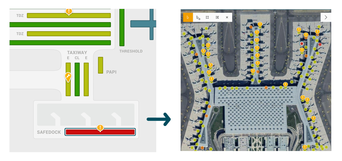
Satellite view overlay

Use Case
By using the satellite add-on, you’ll be able to better assess the maintenance condition of your assets, and its scale and severity.
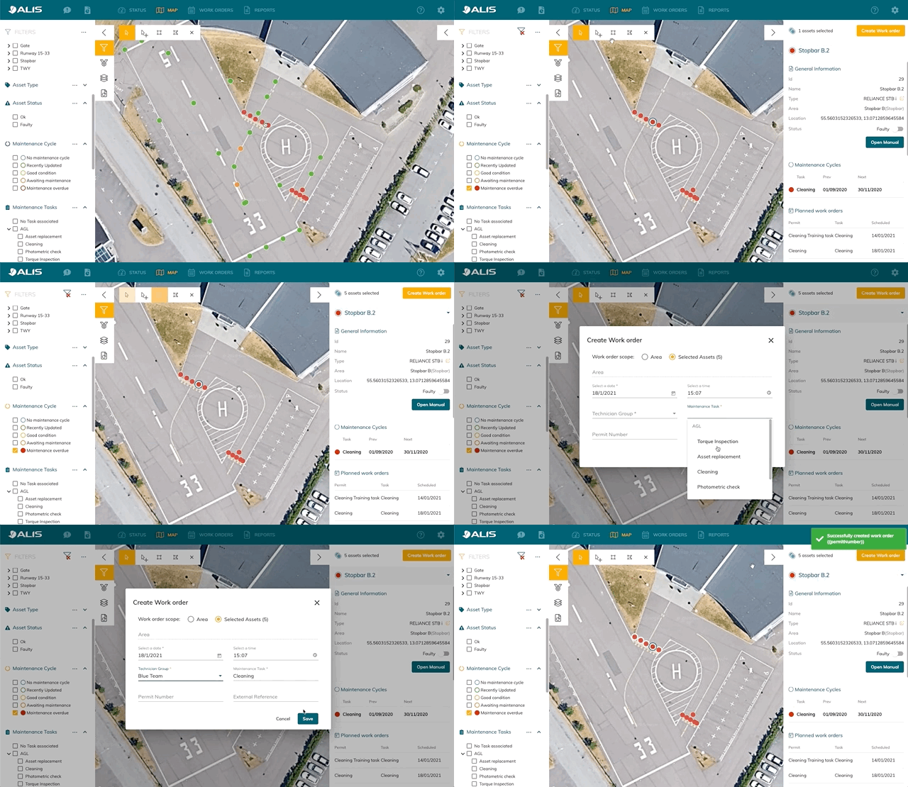
It allows you to schedule work orders in a visual way by drawing polygons or rectangles over groups of assets to precisely define and scope the maintenance task or inspection at hand.

Requirements
To enable the ALIS Satellite add-on, you will have to supply the system with valid geographic location information. That can be done in the UTM format or WGS 84 (Google maps format). Other local reference systems can be converted by ADB SAFEGATE upon request.
A base layer for advanced features
For some optional features, you’ll be required to have the ALIS Satellite add-on enabled, as they require GIS information in order to visualize those functions (ie: Photometrics and ALIS on-site).
Satellite view overlay
Upgrade the generic airport view to a real GIS map with your assets visualized on their actual locations. This allows for a quicker and better view of your asset status, and the size of the risk area. The add-on requires you to have geographic information for your assets and is hands down the best upgrade you can make in ALIS.
